 By Rob Case, PhD, PE
Chief Transportation Engineer
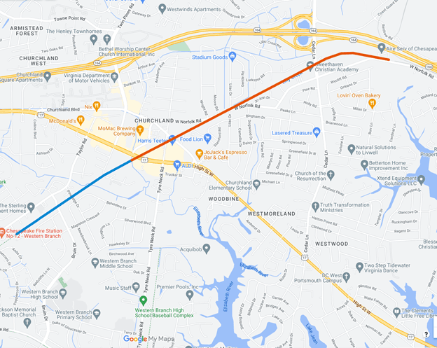
2.7 miles of multi-use trail for pedestrians, cyclists, etc. are nearing completion in the Churchland area of Chesapeake and Portsmouth. The Chesapeake portion—from Dordon St to the Chesapeake/Portsmouth boundary near High Street (0.9 mi)—was completed in 2021. The Portsmouth portion—from the Chesapeake/Portsmouth boundary to Old Coast Guard Blvd (1.8 mi)—is mostly complete, the project having a few short gravel portions remaining to be paved.
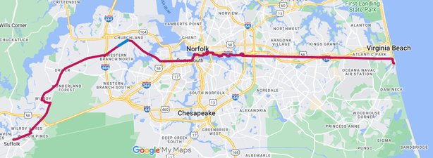
The Chesapeake portion is part of the South Hampton Roads Trail (SHRT), planned to run from downtown Suffolk, through Churchland, downtown Portsmouth, downtown Norfolk, all the way to the oceanfront of Virginia Beach. (The Portsmouth portion is a spur off the SHRT.)
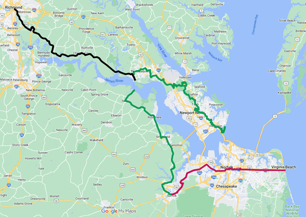
And the SHRT, in turn, is part of a planned trail system from Richmond to the oceanfront, comprised of the Virginia Capital Trail (VCT), Trail757, and the SHRT.
Being built in an abandoned rail right-of-way, this rail trail can be reached:
- via the streets that cross the trail
- via paved stubs to streets that end near the trail
- directly from adjacent properties,
as shown by the following three photos:
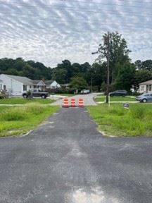
 Poplar Hill Rd connects Brickhouse Farms neighborhood to the trail Poplar Hill Rd connects Brickhouse Farms neighborhood to the trail
Source: HRTPO staff
|  Connection between Marsha St and the trail Connection between Marsha St and the trail
Source: HRTPO staff
| 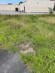 Informal path between shopping center and trail Informal path between shopping center and trail
Source: HRTPO staff
|
Visitors from outside Churchland can drive to the eastern end of the trail and park along Old Coast Guard Blvd where the trail begins/ends. The Chesapeake portion has benches along the trail, and the Portsmouth portion will have benches when fully completed. Once the Portsmouth portion is complete, the full 2.7 miles can be used by all.
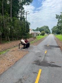 A couple sits along the trail A couple sits along the trail
Source: HRTPO staff
| 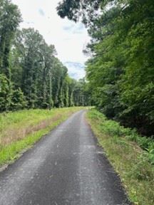 Rail trail in Portsmouth and Chesapeake- Portsmouth portion Rail trail in Portsmouth and Chesapeake- Portsmouth portion
Source: HRTPO staff
|