 FishSwimPlay.com is a website that was created by the HRPDC in 2018 to promote water access sites and recreation in Hampton Roads. It is the public outreach component of the Regional Strategic Plan for Public Access to Waterways report which analyzed water recreation and available sites in the region. As a part of that project, an inventory of water access sites was developed and published as an interactive web mapping application.
Since then, FishSwimPlay has been a popular website for the public to locate information about water access sites in Hampton Roads. However, web mapping technology has evolved and so the existing platform required an update. FishSwimPlay was redeveloped and redesigned to give the public a more streamlined experience.
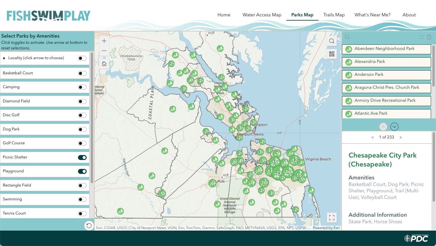
The information on the website was also expanded with a new inventory of public parks and recreational trails. Now visitors can view a map for water access sites, parks, and trails. Visitors can browse, search, or filter sites by amenities, such as kayak launches, boat ramps, basketball courts, playgrounds, hiking trails, and paddling trails.
There is also a “What’s Near Me?” tool which identifies how many of the recreation sites are within a certain distance of a chosen address or point.
FishSwimPlay brings together over 900 recreation sites in Hampton Roads which can be searched from one location.